We really haven’t blogged about where we are volunteering this summer. It is called the Chena River Lakes Flood Control Project.

Welcome to the northernmost flood risk mitigation project operated by the Corps of Engineers in North Pole, AK. Authorized by Congress after the devastating 1967 flood,


In the summer of 1967, one of the worst disasters in the history of Alaska struck the Fairbanks area. Unusually heavy rains swelled the Chena and Little Chena rivers six feet above their flood stage. Water poured into downtown Fairbanks and the outlying regions, driving residents to their rooftops and eventually displacing nearly 7,000 people from their homes.
The Dam and associated features reduce flooding to the interior Alaskan city of Fairbanks, as well as providing local residents and visitors a myriad of recreational opportunities on nearly 20,000 acres of public land. Construction began in 1973, and the Corps completed the $256 million Chena Project in 1979.
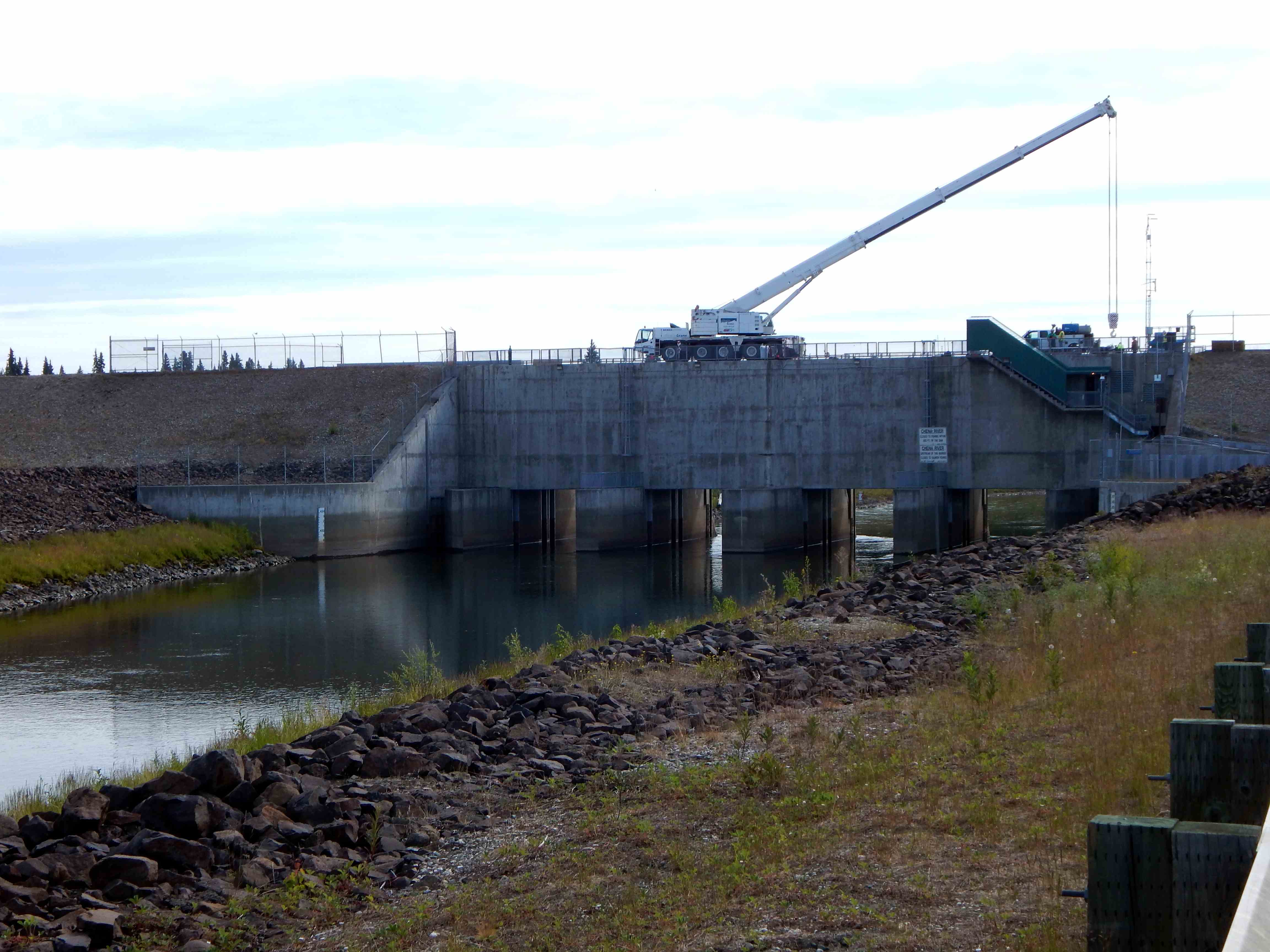
A key component of the dam and levee system, located about 20 miles east of Fairbanks, was the massive concrete outlet works and flood gates. During normal fluctuations of the Chena River, the outlet works remained open, allowing the natural flow of water. Fish, as well as boats, continued to travel through the open gates. At periods of high water, however, the Corps lowered the flood gates, directing excess water to the Tanana River.
The Chena River flows west. This picture was taken down river looking east just a few feet from our camp site.

During normal river levels this is how the up river side of the dam looks.

During high flow levels called an “Event” the river washes a lot of debris down the river. A crane is lifting large trees and debris from the river.
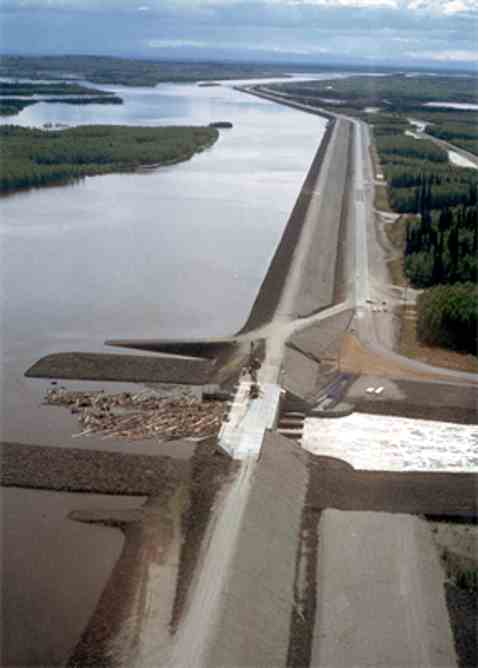
An aerial picture looking south during a high water Event . Much of the river is being diverted south along the levee to the Tanana River.

The entire dam and levee is 8 miles long running north and south between the Chena and Tanana Rivers. You can see part of the Chena Lakes on the left side of the picture. The local Borough (i.e. county) controls the lake and its campground and picnic areas. The buildings in the center are the offices and maintenance building for both the Corps and the Borough.
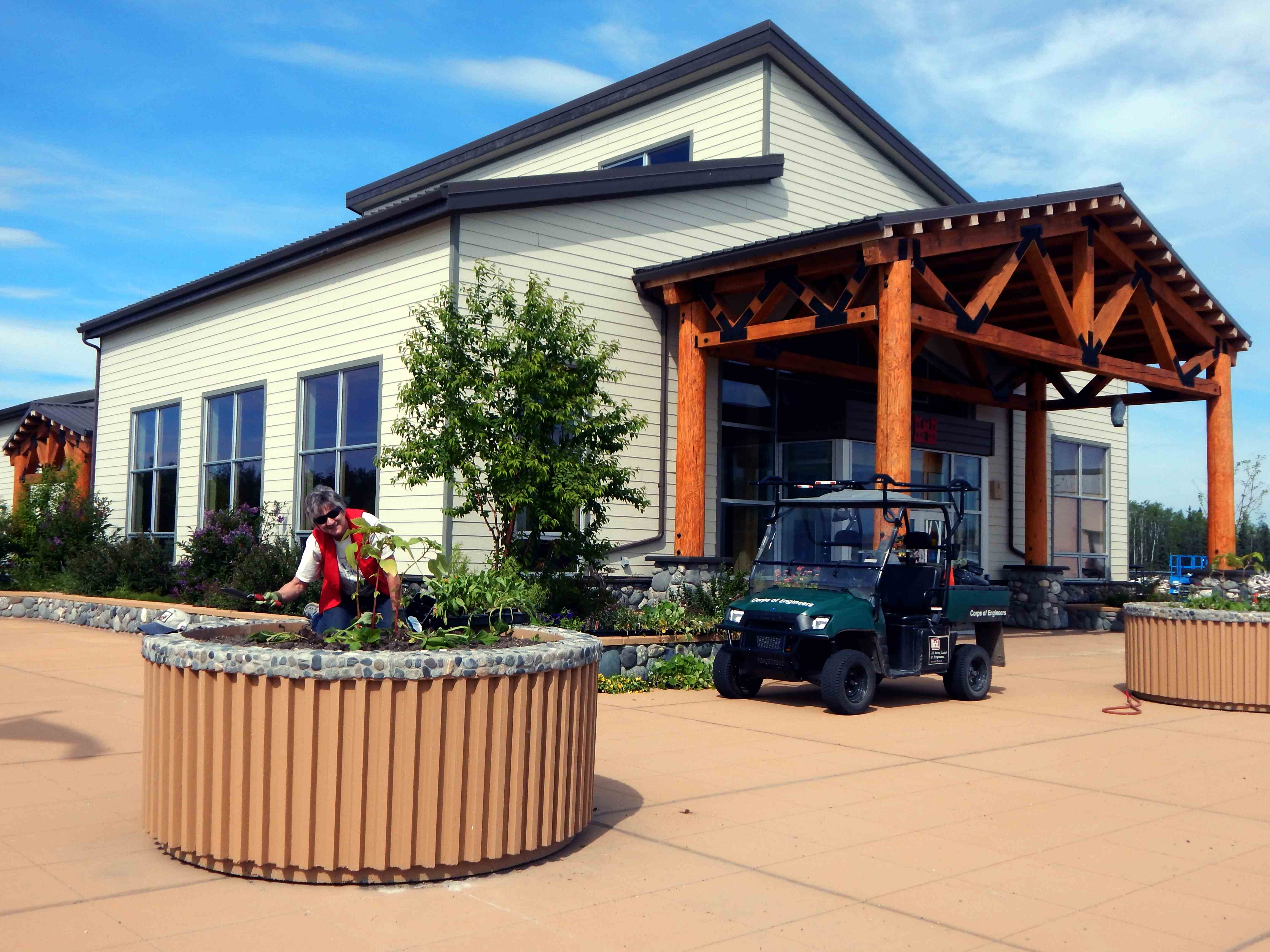
Our office which is the Corp office and visitor’s center. That’s friend Connie planting flowerrs.

Looking north this road runs 4 miles long from the entrance gate to the Mills trailer and next to the levee.

Our trailer parked at a Host Camp site looking south.
Cliff
